University of Minnesota
http://www.umn.edu/
612-625-5000
http://www.umn.edu/
612-625-5000
Minnesota Biodiversity Atlas
Bell Museum
Dataset: MIN-Plants
Search Criteria: Nicaragua; Rio San Juan; excluding cultivated/captive occurrences
1
Page 1, records 1-6 of 6
Bell Museum plants | |
 MIN:Plants | 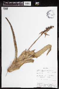 Aechmea angustifolia Poepp. & Endl. 438202[1345048]Rueda, Ricardo 18201994-07-06 Nicaragua, Rio San Juan, Spanish Creek, spout of Agua Negra, branch of Rio Indio., 0 - 100m |
MIN:Plants | 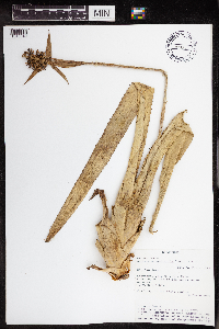 Aechmea angustifolia Poepp. & Endl. 438201[1345049]Rueda, Ricardo 25531995-01-05 Nicaragua, Rio San Juan, Caño Negro and Caño Pescado. Greytown, 11.90864 -83.893528 |
MIN:Plants | 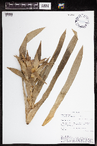 962410[1345077]Rueda, Ricardo 25161995-01-04 Nicaragua, Rio San Juan, Rio Indio, entry to Greytown and the division of Pimienta and the Indio. Greytown, 10.94684 -83.734665 |
MIN:Plants | 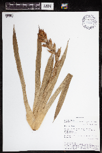 Guzmania monostachya Rusby 962420[1345098]Rueda, Ricardo 20241994-07-15 Nicaragua, Rio San Juan, Along the River Sábalos, starting off at the town Boca de Sábalos., 11.05 -84.466667 |
MIN:Plants | 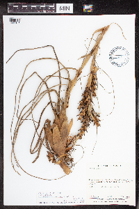 Tillandsia balbisiana Schult. & Schult. f. 493876[1345146]Sandino, J.C. 17821981-12-17 Nicaragua, Rio San Juan, W de San Carlos, 11.134363 -84.833771, 30 - 35m |
MIN:Plants | 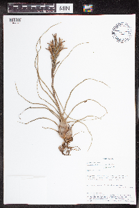 Tillandsia bulbosa Hook. 438618[1345147]Rueda, Ricardo 44651996-07-24 Nicaragua, Rio San Juan, Indio-Maiz Reserve. Gigante Hill., 380 - 412m |
1
Page 1, records 1-6 of 6
Google Map
Google Maps is a web mapping service provided by Google that features a map that users can pan (by dragging the mouse) and zoom (by using the mouse wheel). Collection points are displayed as colored markers that when clicked on, displays the full information for that collection. When multiple species are queried (separated by semi-colons), different colored markers denote each individual species.